Saturday, June 24, 2017

Hiking The Thames Valley Trail: Section 2--Sharon Creek and Section 3--Sharon Creek to Delaware

   I had this past week off and Thursday I took the opportunity to hike some more of the Thames Valley Trail.
   I had decided to combine the next two sections---Sharon Creek and then Sharon Creek to Delaware as the Sharon Creek section was only 4K and the Sharon Creek to Delaware section was only 8K. On top of that, because of my slight navigation error near the end of the first section, I had decided to go back and re-hike it. This was a further 2K so, all in all, about 14K. This seemed doable.
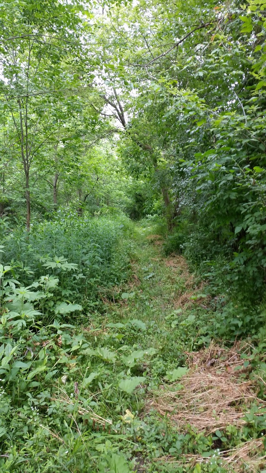
The "green gate" and then walking along
another farmer's field, headed for
Carriage Road.
   I had my stepson, Quin, meet me at the Delaware Conservation Area, which was the endpoint, so that I could leave my car there for the ride home. He then drove me back to the spot on the first section I needed to do over---the infamous "green gate". I headed out from there.
   The rest was kind of a debacle.
   Thursday was hot and when I set out it was about 34C (93F) and very humid. I kind of enjoy hot and humid so I didn't think this would be a problem. I completed the last portion of Section 1 with no problems and then set out on Section 2-Sharon Creek. The hiking here was more difficult than the first section with lots of steep hills. It was very scenic, though, and this always tends to make up for some of the difficulty. This section ends at Sharon Creek Conservation Area and I took this opportunity to chow down a little and sit for a bit. At this point I knew I was already tired but still had 8K of hiking ahead of me and figured I had done tougher things.
   Well, that 8K Sharon Creek to Delaware section was brutal---some of the steepest and most technical trails I have ever been on. Much of this was exacerbated by the heat and already having done one whole section and a part of another. I started rationing the water and still had run out substantially before I was done. At one point I had to stop because I actually thought I was going to throw up. Finally I made it to the town of Delaware and at that point it would have been a short little jaunt to where my car was (which I desperately wanted to reach) but, no, in order to follow the guidebook I first had to travel down a deserted road, under a highway and then along the river before I could get back to my car.
   This was where I started to have some major physical issues. This last part involved clambering down a couple of  different concrete rockfalls and steep slopes. At this point, thigh and calf cramps began to set in. After overdoing it, I tend to develop excruciating inner thigh cramps and I actually envisioned not being able to make it back to the car. I gave them a few moments to subside and then I gingerly made it the rest of the way.
   So.... many lessons were learned Thursday about planning, hydration, fueling and better knowing my body's limits. The trail organizers start off with a 15K section and then follow that with a 4 and an 8K section and, on paper, I couldn't figure out why the second two weren't combined. Well, now I know!  
   At any rate, here is another photo dump, more or less in the order I took them!


Re-hiking the last part of the first section
got me all the way back to Carriage Road
and Sharon Road. It was pouring rain the
last time I was here...

A quick walk up Sharon and I'm at the
beginning of Section 2--Sharon and Springer


Springer takes a hard right and becomes
Heatly Drive. Nice pleasant little walk!

After a short stretch on Heatly, you arrive
at the footpath into the woodlot. Lots of
deer in here and I scared a lot of them.

Scenic little bridge

A little more scenery

And I'm at the end of the second section,
sort of wondering what I've gotten myself
in for. Tired at this point but
still optimistic...

A little highway walking down Springer
til I have to turn left into another farmer's
field. Things start to get a little rough
in this section... 

They use many of these small wooden boxes
covered with wire mesh (traction) to
get you through the boggy areas.

The ever-present power lines, getting
closer to Highway 402.

Crossing over Highway 402.

Just on the other side of the highway,
these steps take you down. The pic
doesn't do their steepness credit.

More scenery! There's a river in there you
just can't see. At this point I was struggling
and actually didn't have the energy
to take any more pics. Hard hiking here!

Finally back to Delaware. This is Pleasant
Street. And it was quite!

The deserted road which used to be part
of Highway 2. There was a wide wooden
barricade at this point and a strip of
caution tape, all of which suggesting
to ordinary people that you shouldn't
go down there. I went down there...

...and came across this rather hellacious
descent into a small ravine. I'm looking
up from the bottom in this pic.

A short walk takes you to the buttress
for the old Highway 2 overpass

I then ended up under the newer overpass.
Some cool graffiti, with ladders and
scaffolds even! I was having
major cramp issues at this point.

A  short walk along the river and I am
back at the Delaware Conservation area,
where I had left my car. Never so grateful!


Monday, June 19, 2017

Hiking The Thames Valley Trail: Section 1--Southdel Road to Sharon Creek

   Ever since I heard about the Thames Valley Trail (TVT) late last summer, I have been eager to find out as much as I can about it and, then, hike it.
   Over the winter and early spring I managed to do a little research and also managed to get my hands on a copy of the trail guide (not real easy to come by). I've been taking a look at the maps and directions and yesterday I actually set out!
   The TVT starts near Southwold, just a little southwest of London. The idea for the trail started in 1968 and over the years the sections have been worked on individually and then eventually all connected to each other. It is linked to the Elgin Trail at the south end and the Avon Trail at the north end. The TVT section is 110 kilometers long. My plan is to eventually have hiked the whole thing and, hopefully, will accomplish that this year.
   Doralyn, my wife, and I arranged to have her drop me off at the beginning of the trail and the idea was for me to call her as I was nearing the end of the trail, to come and pick me up. The original plan was to hike the trail together but Doralyn doesn't do hot and humid and yesterday was hot and humid.
   
Me, standing beside the signs
which mark the end of the Elgin
Trail and the beginning of the
Thames Valley Trail.
Initially we drove right past the marker for the trail on Southdel Road. The marker was actually much easier to see coming from the opposite direction and Doralyn, with her eagle eyes, spotted it. It was hot and windy and the skies off to the west were a little ominous. Both of us were wondering if this was a good idea or not but I did have rain gear packed so it was still a go. Kissed each other goodbye and off I went!

   Right off the bat, the first part of the trail involves hiking along country roads. I had taken the directions and the map out of the trail guide and brought them along with me and got to following them right away. After a little more than a kilometer, I was finally into woodlot. Before I got to the woodlot, however, I had to hike along the edge of a farmer's field. This was a common theme for the next four hours---country roads and farmers' fields, with the odd woodlot thrown in. When you think of trails you think of woodlands, mainly, but I would estimate that about three quarters of this first section of the trail is on roads and fields. I found this a little strange but at the same time I don't think you can travel all the way from Southwold to St. Mary's without hitting the roadways for good stretches. So be it!
The start of the TVT!

   In fact, I kind of enjoyed having the country road sections included---there were probably only 6 or 7 cars which passed me and much of my hiking time was spent in quiet contemplation of my pastoral surroundings. There is some kind of spirituality in the forest and there's a different kind out on the dusty roadways.
    All in all, the 15K hike yesterday was very enjoyable, perhaps apart from the final 2K. At this point, the threatening skies finally darkened and opened up. I had about enough time to get my rain jacket out of the backpack and get it wrapped around myself. Unfortunately this only covered my top half. My shorts got drenched and the rain got inside my waterproof boots, which meant it stayed there. A learning experience for sure! 
   At this point, I am looking forward to tackling more sections of the TVT. Ironically, as I was looking ahead to the sections which pass through London I realized that my street is part of the trail! Unfortunately, as I was looking at the trail maps, I went back and took a second look at yesterday's section and found I'd screwed up---I'd made the mistake of only following the written directions and not the map itself. Because of this, I had missed one whole section of farmer's field. I drove past it today, trying to see where I'd made the mistake and there it was, plain as the nose on my face--I'd missed the "green gate"....Oh well, when it comes time to do the next section I'll just go back to the "green gate" and start over. And I can't wait!
    The following is a bit of a photo dump, all pictures I took yesterday, more or less in the order I took them. Enjoy!

Turning from Southdel onto Carriage

Off of Carriage and off to see
this big tree in the middle of a field

Following along the edge of this
farmer's field. This happened a LOT.

At the edge of that farmer's field is
where you go into the forest for the
first time. This giant uprooted tree
greets you there!

From there, it's just a regular trail.
Except for the two huge wild turkeys
I scared the heck out of.

After the woods, it's a trip through
a cornfield and then you're on Bell
Road, with hardly any cars.

A scary tree, though...

Off of Bell Road, through yet another
field and you're into a forest with
a cool wooden bridge over a
ravine with s stream.

This is the stream and the ravine.

Stepping out of those woods brings
you to a huge wheat field.
Once again, hiking along the edge of a
field. Very pretty though!

A couple of turns and it's a different
field with a different crop

Eventually out of the fields and into
the last woodlot. It was here
that I vowed to pick up bug spray!

After the buggy forest, you end up back
on Bell, which takes you to
Westminster Drive which then takes
you to THIS intersection,
Westminster and Carriage. You only
get here, though, if you don't read
the directions carefully or follow
the map---grrrr!

Carriage will take you to Sharon Drive
which , in turn, leads you to Springer
Drive and the end of the section!


Monday, June 5, 2017

White Blazes And A Tiny Bit Of Running

   This past Wednesday, I decided to go for a bit of a hike and, because I had not run in about two months, a short run as well.
   For the past while, my problematic right knee has kept me from running and, just when I thought I might be able to run again, I've aggravated the injury so...no running. Wednesday, however, seemed like the perfect opportunity to give it a bit of a go.
   Instead of my hiking boots, I wore my trail-running shoes and headed into the woods right near our house. From here it was a short hop into Warbler Woods and, once out of Warbler, I was headed for Kains Woods, less than a kilometer away.
   My plan was to take the tunnel under Commissioners Road and then on to Oxford Street, down toward the Oxford Street bridge and then on to the Kains Woods entrance near the bridge.
   As I left Warbler and headed up the street toward the tunnel entry I noticed, for the very first time, the white blazes which mark the Thames Valley Trail (TVT). The TVT is a system of trails which you can follow from just southwest of London, through London, and then on north to St Mary's. There is already a system of trails here in London's environmentally significant areas (ESAs) and, as it passes through London, the TVT overlaps many of those systems. Because of this, I am quite familiar with the portions of the TVT inside London. 
   The ESA trails are marked with yellow blazes so, in the forested areas which also house the TVT, the white and yellow blazes are posted together on the same trees. This I'm used to. What I was noticing (somehow or other for the first time) on Wednesday, though, were all the TVT white blazes along the urban streets and pathways. Although I already knew where I was going, I decided to follow the blazes, almost as if I didn't, as if I were seeing them for the first time.
The first trail marker as you leave Warbler Woods. The top blaze
being offset to the left indicates you need to head left.
The next marker you come to has the top blaze offset to the right,
indicating a right turn up at the end of that row of houses.
That right turn takes you into the tunnel, also marked by a white
blaze, which then takes you past a collection pond and up to...
...Oxford Street, headed east toward the bridge.
Down by the bridge is another slightly offset blaze
which directs you down and...
...under the Oxford Street bridge. Note the white
blaze on the bridge's under-structure.
After passing under the bridge, you scramble up the other
side and come across another marker. This marker is for
hikers going in either direction. For me, it
        meant a turn to the right and up the hill and into Kains Woods    
   Once into Kains Woods, I decided I would wait for a less technical part of the trail in order to test out the actual running. I went up and down some gullies and ravines and then I decided to try a slow trot. The right knee had been feeling pretty strong lately and I had actually tested it a few times by running across rooms and things and it had given me no problems. Occasionally, though, just walking around, I would get it into a funny position and it would give me a good jolt. I also knew that trail-running gets your legs and knees into "funny positions" sometimes, so I had a little trepidation. 
   Well, I guess I shouldn't have been worried. The knee held up just fine and didn't feel really any different than the last time I was able to run regularly. My plan was to run for only a kilometer and I stuck to that, feeling good about how the little experiment had gone. All in all, I hiked 11K and ran 1K.
   I think I did, however, overdo it. My knee for the next few days was toast, and any little misstep caused great pain. I believe that this was as much from all the extra walking as the little bit of running so I may do things differently the next time. After four days of rest it is only now starting to feel good once more. Lesson learned I guess!
   But, man, it felt good to run through the forest again....